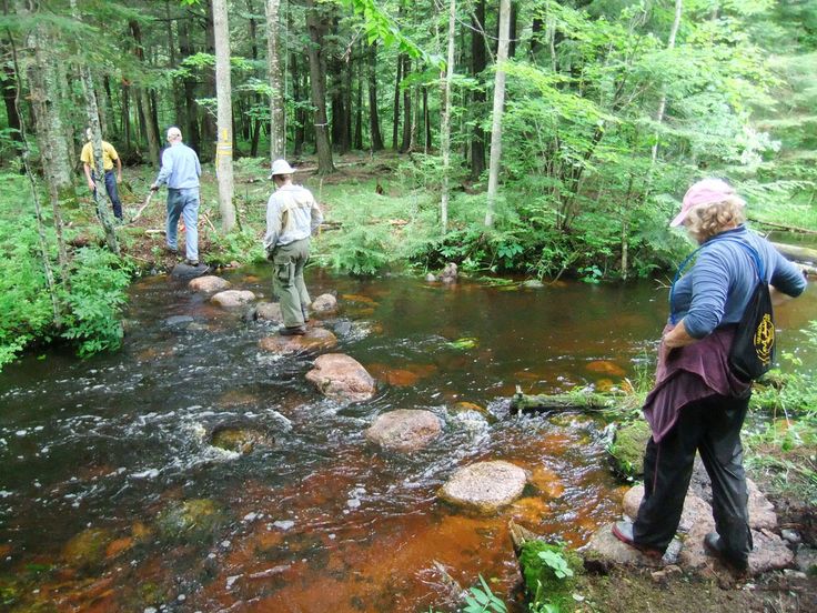
Five of The Best Intermediate Spring Hiking Destinations in the Midwest
Somewhere between the Appalachian and the Rocky Mountains lies the Midwest: an area of serene beauty, unpredictable weather, and hiking destinations that rival any in the continental U.S. In the upper Midwest, you’ll find thick forests full of wildlife and, in the warm season, complete with a lush green landscape. Near the Mississippi River, you’ll find rolling hills, cliffs, and ledges. Just as the Midwest is an unpredictable landscape ranging from lakeside dunes and flatlands to ambitious inclines, the range of hiking opportunities is wide and versatile. Below, are five of some of our favorite hiking destinations in the Midwestern United States.
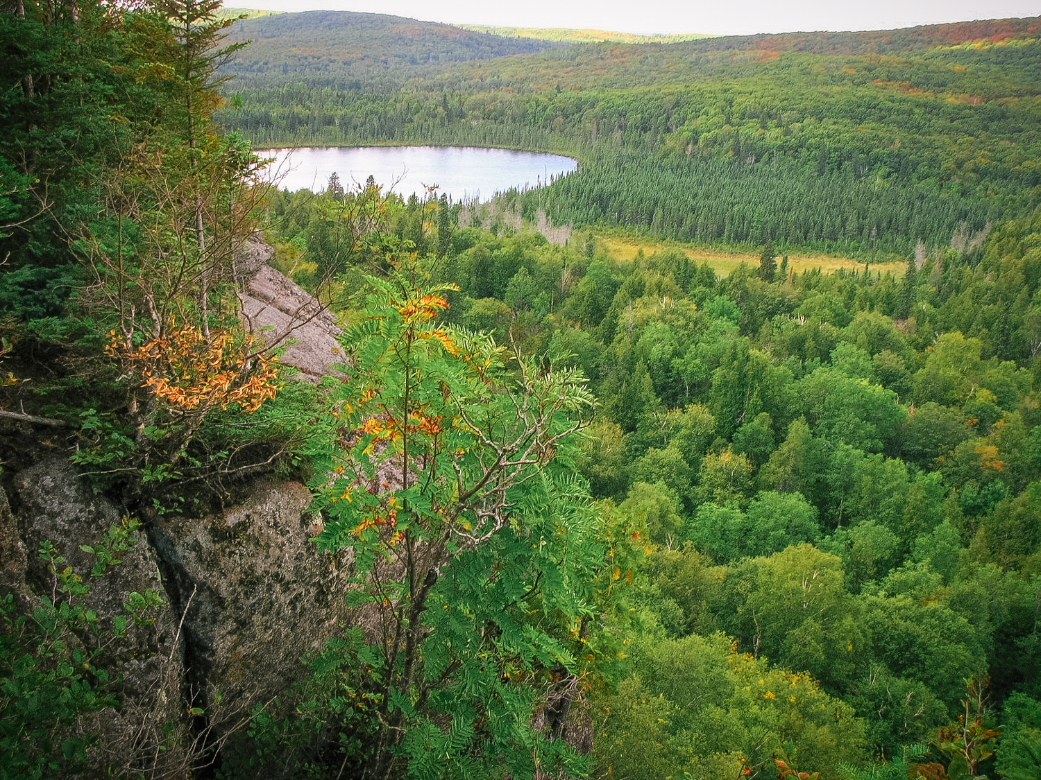
1. Superior Hiking Trail, Minnesota
It’s not just the name that makes this hiking trail superior—it’s the view. Though the entire trail goes for some 300 miles, you’ll have a fantastic time starting at Duluth, MN to Lismore Road. Duluth’s view of Lake Superior includes a view of ponds and mixed forestry which means a wide degree of wildlife, from shrubs to towering trees. The flat lakeside land here makes for a quick pace that will allow you to move on for a greater challenge.
Pros: View, Challenge, Variety
Cons: Weather (in off-season)
Congestion: Low
Ideal Time of Year to Hike: Spring, Summer
Total Distance and Duration: ≈300 Miles, 6.9 miles from Duluth to Lismore Road
Trail Uses: Hiking, Running
Dogs Allowed? Yes
Recommended Gear: Day pack, Hiking boots, Ice Ax and Winter Gear in cold months
Elevation at Trailhead: ≈702’ at Duluth, MN
Costs: None
Directions: From website: “From I-35, take 21st Ave. East Exit #258. Turn left on 21st Ave. E. and go 0.7 miles up hill. Turn right on Woodland Ave. and go 1.2 miles. Turn right on Snively Rd. and go 1.0 miles to intersection with Jean Duluth Rd. Continue straight on Jean Duluth Rd. and go 1.9 miles. Turn left on Martin Rd. and go 1.2 miles to trailhead parking lot on left. Overnight parking okay, outhouse at trailhead.”
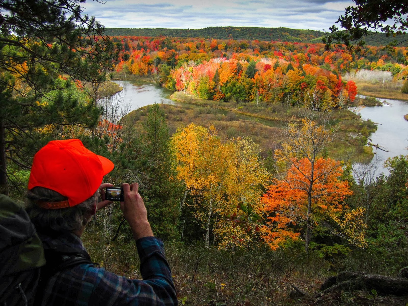
2. North Country National Scenic Trail, Michigan: Manistee River Trail
The story of the Midwest is largely the story of the Great Lakes, as you can see on this list—but the North Country National Scenic Trail offers more than just lakeside views. There is a proper mix here, including farm and forest country in addition to the sandy dunes, giving the full gamut of the Midwestern hiking experience.
Enter at Manistee National Forest to experience the Manistee River Trail for an experience of wild Michigan landscape still unencumbered by modern touches like cottages and even roads. The river is pleasant and even makes for famous trout fishing—on land, you’ll find a good mix of forest and challenging hiking.
Pros: Variety, View, Wide Access
Cons: More of a regional trail than a local one
Congestion: Medium
Ideal Time of Year to Hike: Spring, Summer
Total Distance and Duration: ≈4600 Miles, 11 Miles on Manistee River Trail
Trail Uses: Hiking, Camping, Cycling
Dogs Allowed? Depends on area; ask ahead
Recommended Gear: Day pack, camping supplies, food and water
Elevation at Trailhead: ≈1,000’ near Pittsford, Michigan
Costs: None
Directions: At Manistee National Forest: see campground directions online.
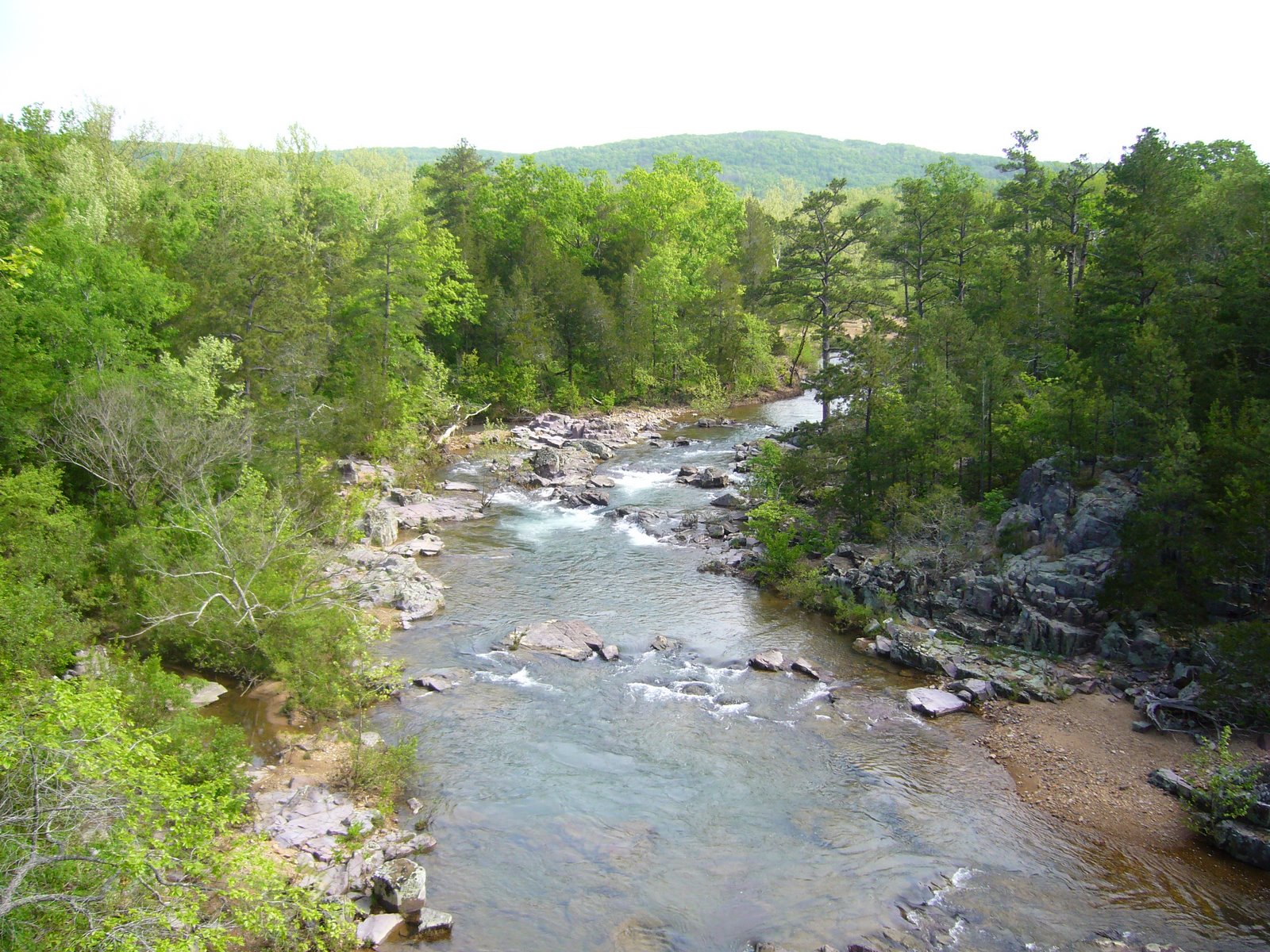
3. Ozark Trail, Missouri, Marble Creek Section
Missouri is a state renowned for its trails, partially thanks to the open land and partially thanks to the quality of that open land. Farther south from our first entry, the famous Ozark Trial goes through heavily wooded areas, forested hills, and frequent changes in elevation to create a nice moderate challenge for even the advanced or more experienced hikers. The Marble Creek Section is a wide, looping path that includes hiking around Crane Lake, which gives hikers a taste of big sky as well as forest canopy.
Pros: View, Variety, Weather
Cons: Especially difficult when it rains
Congestion: Low
Ideal Time of Year to Hike: Spring, Summer, Fall
Total Distance and Duration: ≈400 Miles, 9 miles for entire Marble Creek section
Trail Uses: Hiking, Running, Camping
Dogs Allowed? Yes, use leashes
Recommended Gear: Day pack, Hiking boots, Snacks, Camping Equipment, Leash for Pets
Elevation at Trailhead: ≈1,772’ average state elevation
Costs: None
Directions: From Fredericktown, MO, Head south on US-67, Turn right on Hwy E and follow for 15 miles. You’ll find trailhead access, parking and campground on the right.
4. Point Beach State Forest, Wisconsin
Point Beach State Forest, as the name suggests, provides beachside access to another one of the Great Lakes: Lake Michigan. Like the other Great Lake entry on our list, this state forest is open year-round, but you’ll have the best results in spring, summer, and especially autumn when the leaves begin to change. The combination of rustic beauty and coastal views including dunes and a lighthouse may even feel a little like New England.
Pros: View, Weather, Not Busy, Easy Hiking
Cons: Lack of Elevation Challenge
Congestion: Low
Ideal Time of Year to Hike: Spring, Summer, Fall
Total Distance and Duration: ≈9 Miles
Trail Uses: Hiking, Running, Camping
Dogs Allowed? Yes, use leash at all times
Recommended Gear: Day pack, Hiking boots, Snacks, Camping Equipment, Leash for Pets
Elevation at Trailhead: ≈584’ elevation at Manitowoc, WI
Costs: Camping fees; about $10 per reservation
Directions: From the Wisconsin DNR: “County Highway O north about 4 miles; the entrance road will be on your right.”
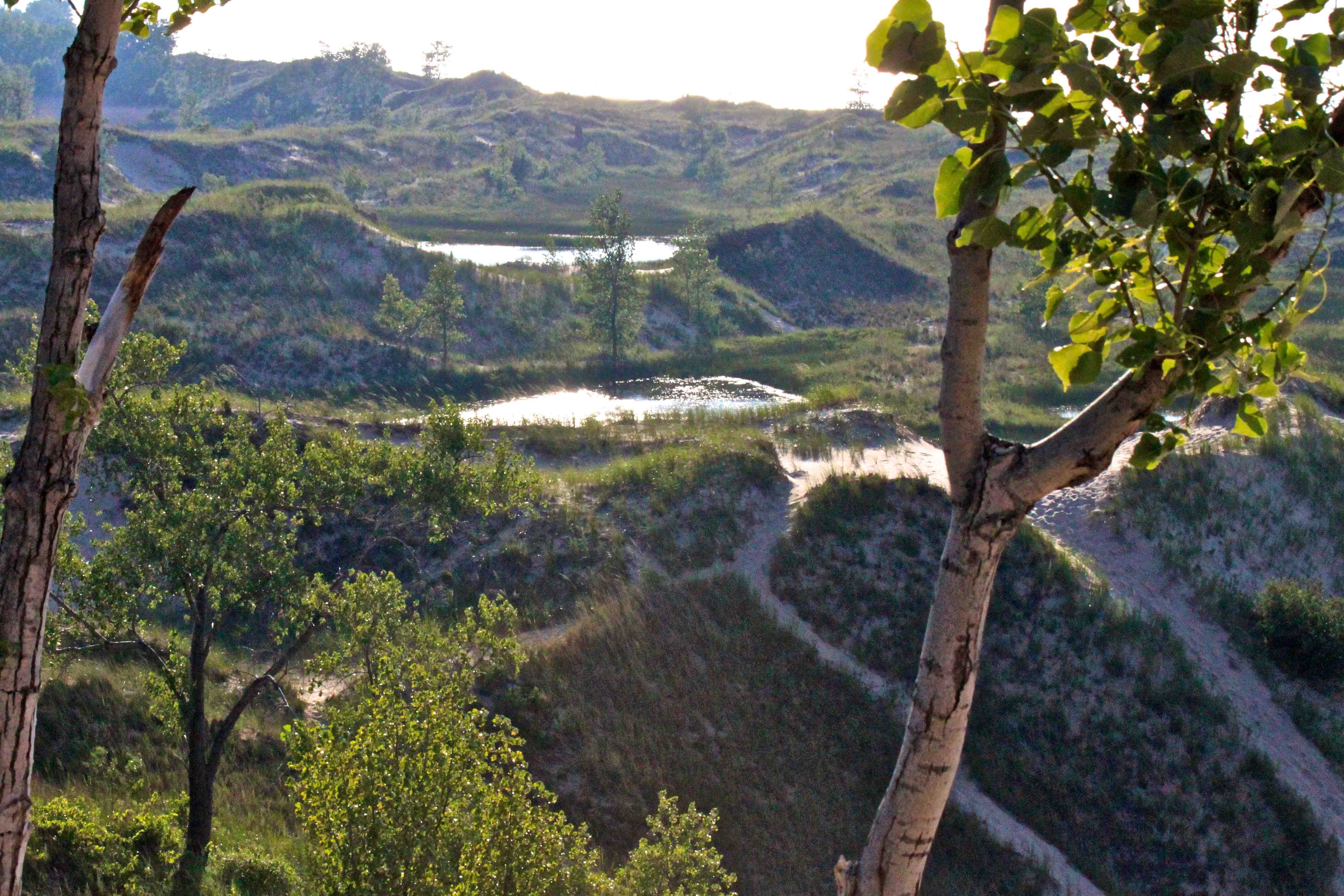
5. Indiana Dunes State Park, Indiana
If you love Great Lakes access but need a little more of a challenge, the Indiana Dunes State Park provides higher dunes with plenty of accessibility on the other side of Lake Michigan. This is more of an “all-in-one” destination for vacationers, but there’s plenty of hiking to be had—and plenty of challenge for the intermediate hiker who loves the Great Lakes beachside scenery but needs a little bit more of a challenge. The distant view of the Chicago skyline makes for a comprehensive experience of the southern tip of Lake Michigan.
Pros: View, Weather, Amenities
Cons: More amenities mean more people
Congestion: High
Ideal Time of Year to Hike: Spring, Summer
Total Distance and Duration: ≈11 Miles
Trail Uses: Hiking, Running, Camping, Vacations
Dogs Allowed? Not on the swimming beach; otherwise, use leashes
Recommended Gear: Minimal—bring a day pack
Elevation at Trailhead: ≈600’
Costs: $12 for out of state vehicles; less for in-state
Directions: Via IndianaDunes.com: “Take State Road 49 North from Interstate 94 or the Indiana Toll Road. It leads into the park.”


No Comment