Five Must-Visit Spring Hiking Destinations in The Western US
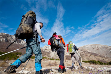
For the avid hiker, spring-time means it’s time to get outside and hit the trails! With the snow melting, milder temperatures and alpine flowers, it’s the ideal time to explore the wilderness in the western United States. So, to help you plan your first of the seasons adventures, here are five must-visit spring hiking destinations in the western US.
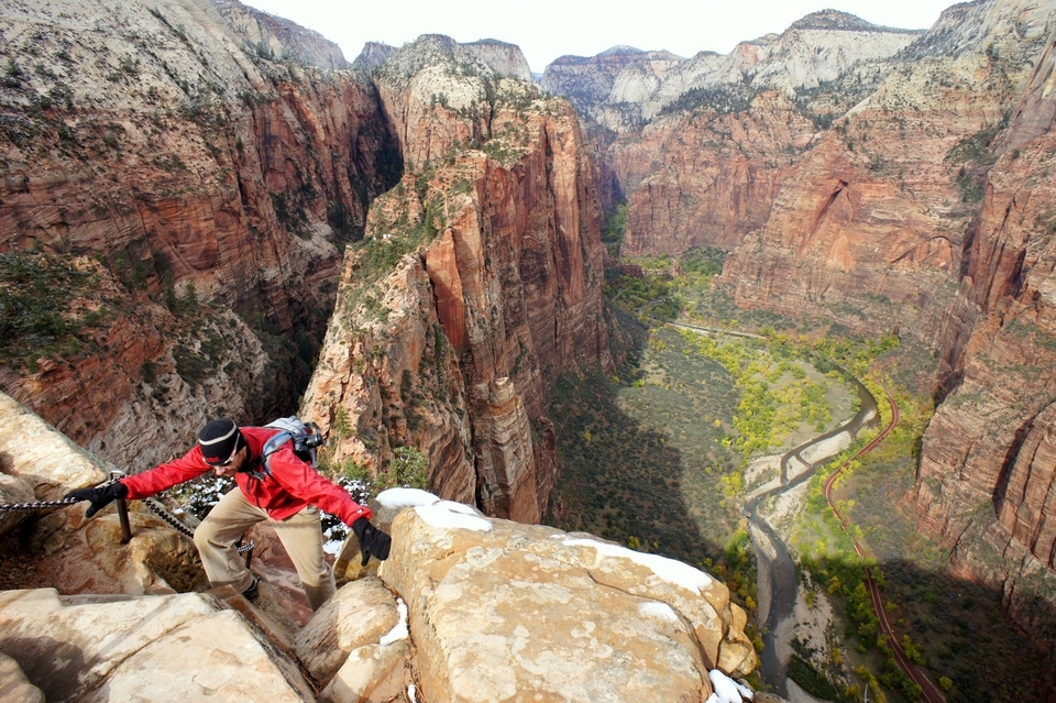
1. Angel’s Landing, Zion National Park
For a hike that you’ll remember for the rest of your life, Angel’s Landing is it! Starting at the Virgin River, the intense red Zion rock contrasts starkly with the bright blue sky as you weave your way up Walter’s Wiggles, a set of 21 steep stonework switchbacks. Then, you’ll head out on a thin, rock saddle with a 1,000ft drop on either side, using carved-out foot holes and an extensive set of chains to reach Angel’s Landing. At the end, you’ll find a wide flat, rock platform that’s a perfect pit stop to admire the stunning 360° view of the Virgin River snaking its way through the Zion Canyon.
Pro tip: For some shade, start this hike early!
Difficulty: Intermediate, Advanced
Pros: Incredible views, well-marked, fun trail, plenty of places to take breaks, restrooms halfway
Cons: Can be crowded, strenuous climb, dangerous drop-offs, hot and exposed
Congestion: High
Total Distance & Duration: 5.4-mile round trip, 4 hours
Ideal Time of Year to Hike: Spring, Summer, Fall
Trail Uses: Hiking
Dog-Friendly: No
Recommended Gear: CamelBak Cloud Walker 18 Hydration Day Pack, Brooks PureGrit lightweight Trail Running Shoes with trail running shoes with rock plates and good grip, Columbia OMNI-Shade UPF 40 sun protection, long roll-up sleeve shirt
Elevation (at trailhead): 4,300ft
Costs: $12 per person for 7 day pass
State: Utah
Directions to trailhead: Park at the Zion Canyon Visitors Center or in Springdale to take the free shuttle to the Grotto from which the trailhead is clearly marked.
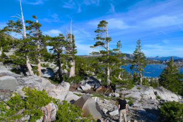
2. Cloud’s Rest, Yosemite National Park
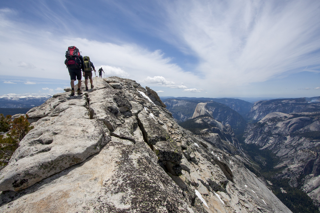
If you don’t have a Half Dome permit but you want a hike with a view to match, hike 1,000ft higher to the summit of Cloud’s Rest. This trail starts off easily as it passes streams, through red fir forests and lupine meadows to begin the ascent. Near the summit, you’ll follow signs to scramble over large, smooth, grey granite boulders to one of Yosemite’s best vantage points, offering 360° views of Half Dome and the Valley.
Pro tip:To avoid the exposed path to the summit, there’s a small unmarked trail that forks to the left before you reach the ‘Cloud’s Rest Food Trail’ sign.
Difficulty: Intermediate, Advanced
Pros: Incredible views, well-marked trail, less crowded for similar experience to Half Dome, streams to refill water
Cons: Exposed climb, can be hard to find parking at trailhead
Congestion: Medium
Total Distance & Duration: 14.4-mile round trip, 6-7 hours
Ideal Time of Year to Hike: Late Spring, Summer
Trail Uses: Hiking
Dog-Friendly: No
Recommended Gear: The North Face Stormbreak 35L Day Pack, LifeStraw Personal Water Filter, Vasque Gore-Tex Waterproof Mid-Length Hiking Boot
Elevation (at trailhead): 8,150ft
Costs: $30 for 7 day pass
State: California
Directions to trailhead: The trailhead is off Tioga Road at the western end of Tenaya Lake
3. Olomana Three Peaks Trail, Oahu, Hawaii

Pro tip: Exercise EXTREME caution on this trail as it’s dangerous and unmaintained!
Difficulty: Intermediate, Advanced
Pros: Incredible views, fun trail
Cons: Muddy, dangerous climb, steep drop-offs, unmaintained ropes system, hard to find parking
Congestion: Medium
Total Distance & Duration: Approximately 5-mile round trip, 3-4 hours
Ideal Time of Year to Hike: Any time
Trail Uses: Hiking
Dog-Friendly: No
Recommended Gear: The North Face Borealis Lightweight Day Pack, Keen Targhee II Waterproof Hiking Shoe
Elevation (at trailhead): 250ft
Costs: None
State: Hawaii
Directions to trailhead: Park as close as possible to the Luana Hills Country Club off of Auloa Road then walk down the access road, passing by the guard shack until you see the trailhead sign on your left.
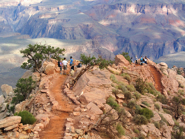
4. South Kaibab Trail, Grand Canyon National Park
Pro tip: Head out early to avoid the heat and watch the sunrise over the canyon
Difficulty: Intermediate
Pros: Short hike, incredible views, well-maintained trail, restrooms at Cedar Ridge
Cons: Hot and exposed, steep, very little shade, no water on trail
Congestion: Medium
Total Distance & Duration: 3-mile round trip to Cedar Ridge, 2hrs, 6-mile round trip to Skeleton Point, 3-5hrs
Ideal Time of Year to Hike: Late Spring, Summer
Trail Uses: Hiking, Mules
Dog-Friendly: No
Recommended Gear: CamelBak Cloud Walker 18 Hydration Day Pack, Merrell Moab Ventilator Hiking Boot, Columbia OMNI-Shade UPF 40 sun protection, long roll-up sleeve shirt
Elevation at trailhead: 7,260ft
Costs: $30 for 7 day pass
State: Arizona
Directions to trailhead: Catch a free shuttle from the Grand Canyon Village to the trailhead
5. Devil’s Garden, Arches National Park

Pro tip: To avoid getting lost, locate the next cairn before you keep walking
Difficulty: Intermediate
Pros: Takes you up close to numerous arches, fun trail, varied landscapes, loop trail, less congestion on the primitive trail
Cons: Hot and exposed with little shade, steep and slippery in sections, no water on trail, relatively unmarked
Congestion: Medium
Total Distance & Duration: 7.2-mile round trip, 4-5hrs
Ideal Time of Year to Hike: Spring, Fall
Trail Uses: Hiking
Dog-Friendly: No
Recommended Gear: CamelBak Cloud Walker 18 Hydration Day Pack, Merrell Moab Ventilator Hiking Boot, Columbia OMNI-Shade UPF 40 sun protection, long roll-up sleeve shirt
Elevation at trailhead: 5,200ft
Costs: $25 for 7 day pass
State: Utah
Directions to trailhead: Park at the Devil’s Garden trailhead lot at the very end of the main road that leads through the park


No Comment